Nav-Unique Introduces Version 2 Offshore and Inshore Digital Mapping For GPS
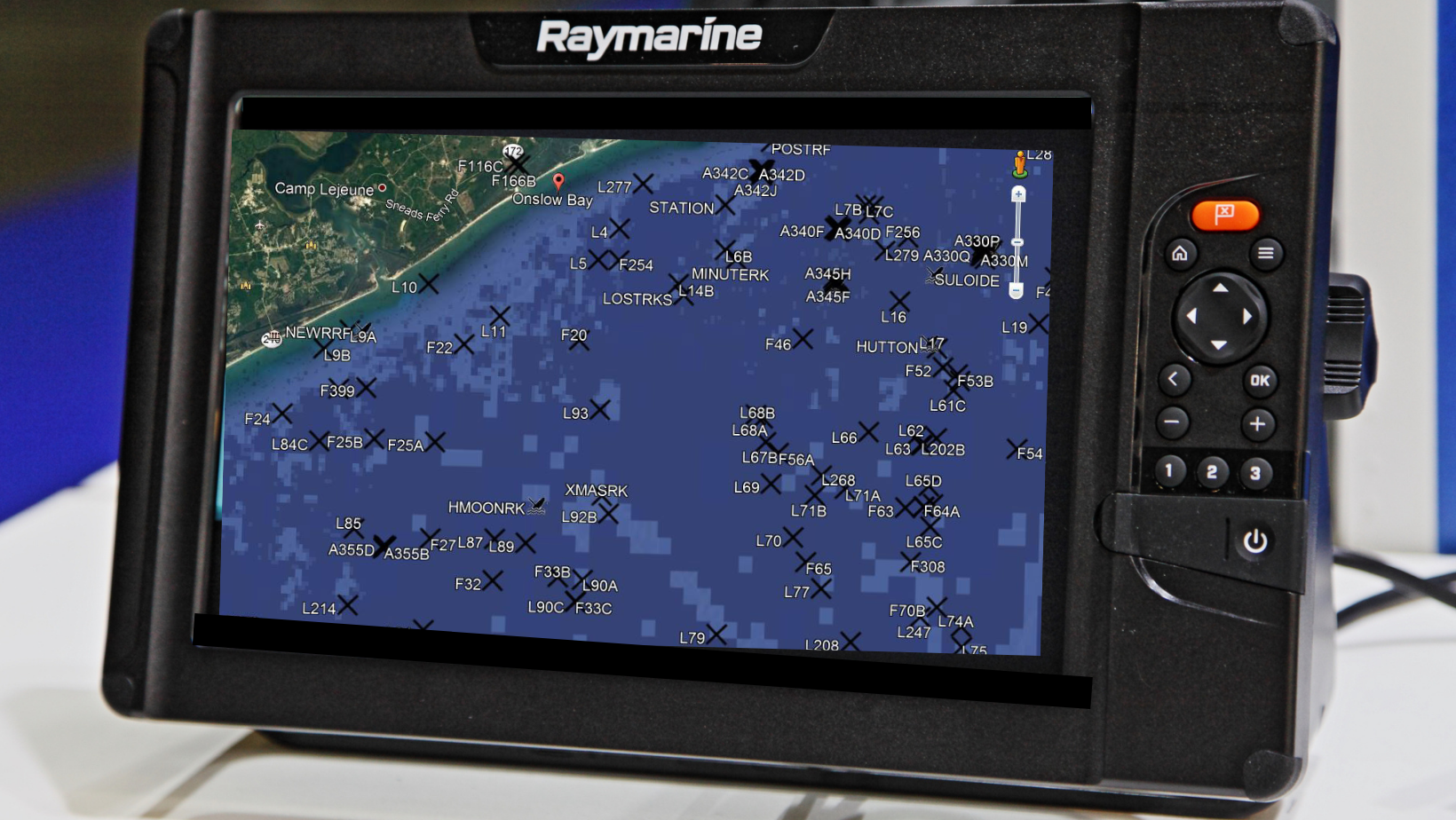
Maps Unique has been a leader in the development of underwater mapping for the nearshore and offshore bottoms of the Carolina coast. In March of 2023, the company introduced Nav-Unique 2.0, their digital version of the Maps Unique product created in 2020. This mini-SD card, complete with a card adapter, allows the angler to load the mapping information onto their GPS. These SD Cards are formatted to work with all popular GPS units, including Garmin, Simrad, Ray-Marine, Furuno, and others.

Since its inception in 2021, the Nav-Unique product has seen extensive popularity with anglers due to its ease of use and precise data. The 2.0 Version, like the original version displayed on the GPS Chart Plotter, includes natural bottoms, artificial reefs, wreck sites, and many location names. Each Waypoint includes a detailed description and comments about that habitat, such as water depth, type of structure, and site identification. Waypoints are numbered to complement the same numbers as found on the printed maps, and are available in 6 geographical areas that extend along the North and South Carolina coast.
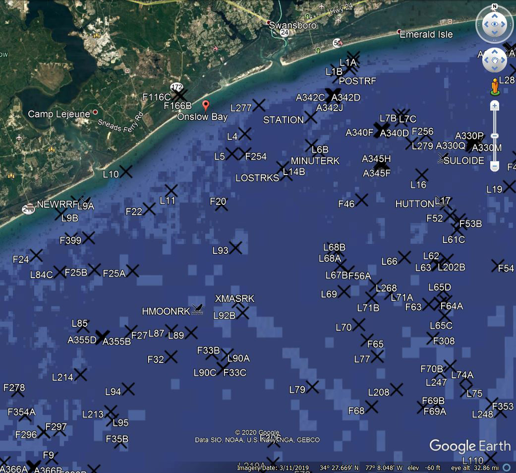
The latest version includes many new locations that had not been present in the previous Nav-Unique or Maps Unique versions. This added feature gives the user additional fishing location options and is particularly attractive to the nearshore fisherman due to many of these new locations being in nearshore areas. Nav-Unique Version 2.0 has a user guide shipped with the product explaining it’s use. Best of all, Nav-Unique provides a live person standing by to answer your questions, should you have any, about the product. A feature almost unheard of today.

The Nav-Unique digital mapping system for your GPS has proven to be a significant competitor to other similar systems. However, the 2.0 version of the chip will likely move the needle past many of the current products of its competitors. It’s more focused on a specific region along the east coast and provides a more detailed product thanks to over 30 years of experience in that region.
You may be interested
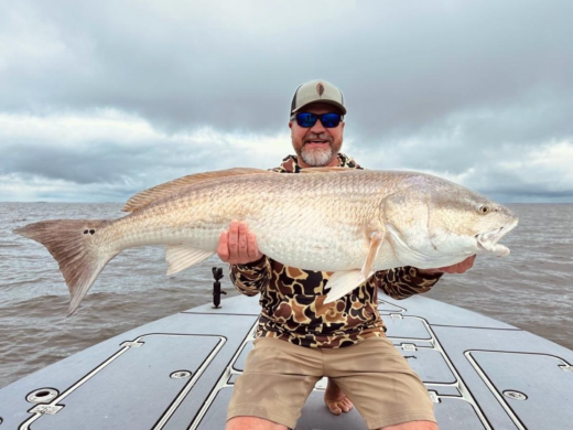
Satellite Tracking Study Aims To Unlock More Red Drum Secrets
Tim Wilson - April 8, 2025A pilot study tracking a popular saltwater fish was not expected to yield as much information as it did in its first year. When the North Carolina…
9 Things Fishing Guides Won’t Tell You
Tim Wilson - April 8, 2025We’re all amazed at how fishing guides nearly always know what to do and where to go to put fish in the boat. Most guides are fishing…
How the Moon Phase Impacts Inshore Fishing
Tim Wilson - April 3, 2025The late spring and early summer months are a time of the year when the inshore goes thru a transition period. It's when the fish come out…
Most from this category